When a massive blaze began to tear through Alberta’s Fort McMurray in May, fire and rescue teams started to take down flames on the ground.
But DigitalGlobe took to the sky, tracking the fire via satellite imagery from space.
The company’s FirstLook team tracked the wildfire’s growth each day, identifying damage and direct relief workers to the right areas on the ground.
“It is critical to understand the landscape in a time like this; actively identifying passable roads and impacted areas can save resources and time,” the group wrote on its blog.
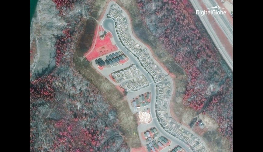
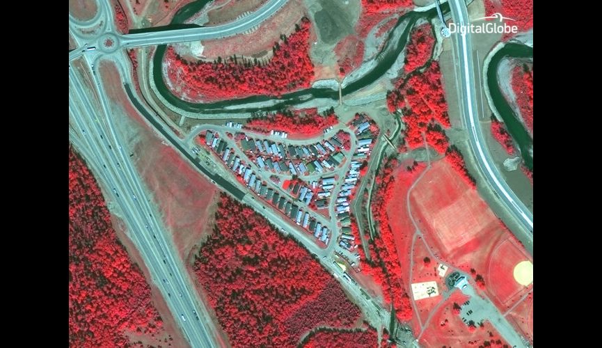
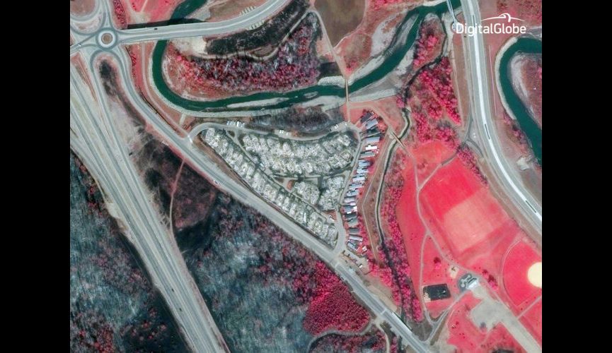
This image, for instance, shows one area of Alberta before the fire — with healthy vegetation in bright red and dead/burnt vegetation in dark colors — and after the fire, with damaged land seen in dark colors and grays.

The group is also using new Shortwave Infrared (SWIR) Imagery that cuts through smoke to more accurately identify fires.
Move the slider to see the image on the right, and uncover what can be seen with SWIR imagery: the smoke disappears, and the hot spots in the fire become clearly visible.
Scroll through the gallery below for more before/after images.